


Tru di pra certified path


Demanding hike on the route of the hiking half marathon Tru di pra in La Val.
This trail has been certified by 'Europäisches Wandergütesiegel' (European Certification for hiking trails).
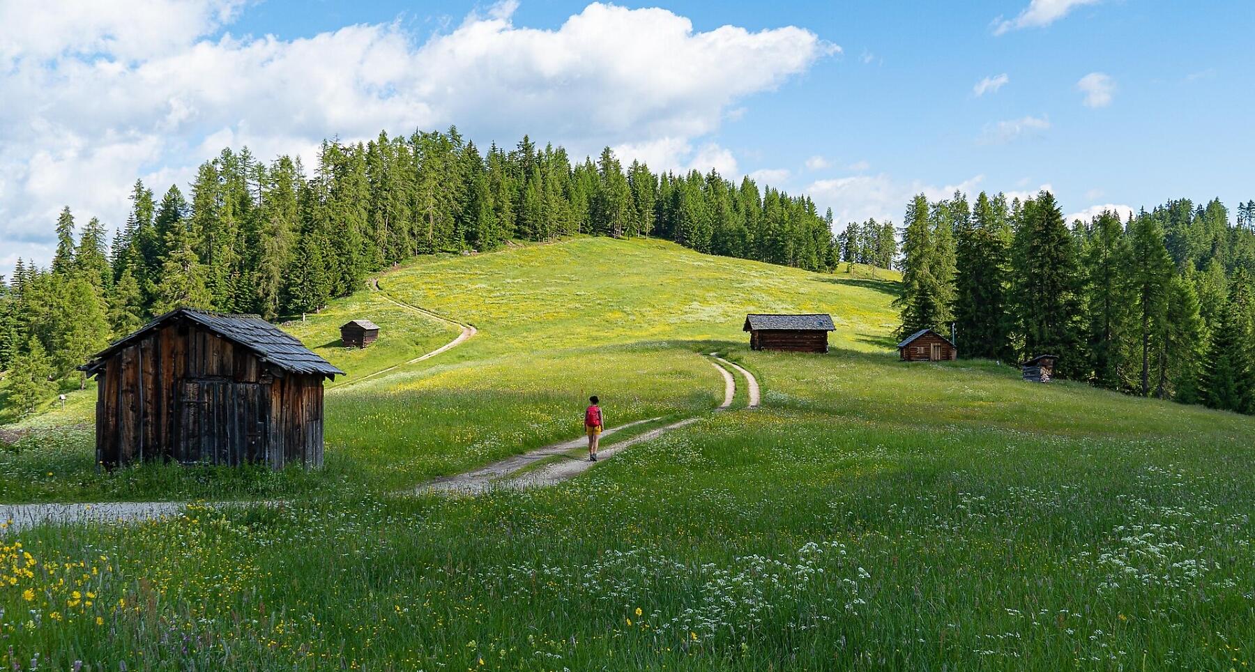
Once you have left the village centre, you will understand why La Val is called the village of Alpine meadows: green, well-kept meadows will constantly surround you during this hike. The man-made landscape between 1300 and 2000 metres above sea level developed through the hard work of our farming ancestors, which today is facilitated by the use of agricultural machinery.
As the altitude increases, so does the consistency of the meadows: from meagre meadows to the larch meadows of Armentara. Along the route you will find wonderful viewpoints, a sulphurous water spring at Al Bagn and several refreshment points where you can refresh yourself with some of the delicious Ladin specialities that can satisfy every palate: try the typical bales (dumplings) or snack on a well-earned slice of strudel.
Every year, the non-competitive half-marathon 'Tru di pra' takes place on this route.
Roadbook
From the village center, follow path no. 6 to the small church of Santa Barbara. From there, continue to the left, arriving at the Ciablun, Runch, and Biei farms. You can also reach this point by car. Head towards the forest, following signs for paths no. 5 and then no. 5B, which lead to the Lech de Rit lake.
Follow paths no. 6 and no. 13 to the Crusc da Rit cross (1934 m). Return to the crossroads and continue along trail no. 13 through meadows and mugo pine thickets to the Ütia da Rit hut. If you choose the variant to the Pares peak (2396 m), you will need to take route no. 16 for the ascent and descent. Otherwise, start your descent along trail no. 13A until you reach the locality of Ciamplorët.
From here, take trail no. 15B, which runs along the Sas dla Crusc mountain walls until you reach the La Crusc hut and its namesake small church (2045 m). Follow path no. 15 for a short distance, then continue left on path no. 15A to the Ütia Ranch da André hut, crossing the magnificent Armentara meadows. Continue downhill on path no. 18A through the forest to the hamlet of Al Bagn. From here, proceed along the paved road until you reach the center of La Val. You can also divide the hike into several stages, with taxis available to assist as needed.
Public transport
Getting to the starting point of the tour or point of interest by public transport is easy and convenient.
How to get there
Follow the SS244 Val Badia road towards Pederoa and continue on road SP60 to La Val.
Coordinates
- DD 46.657790, 11.923844
- DMS 46°39'28.0"N 11°55'25.8"E
- UTM 32T 723696 5171289
- w3w ///necks.bewitch.vessels