


Hike from the Gardena Pass to the Puez - Odle Nature Park in Colfosco


The Puez-Geisler Nature Park in the Dolomites UNESCO World Heritage Site is interesting from a geological point of view - with many typical rock formations and rock shapes.
The Puez-Odle Nature Park, a UNESCO World Heritage Site, is also known as "the witness to the geological history of the Dolomites". The natural park is particularly interesting from a geological and geomorphological point of view, with many typical rock formations and strata that are characteristic of the Dolomites.
The hike in the south-eastern part of the Puez-Odle Nature Park presents no great technical difficulties for hikers.
Roadbook
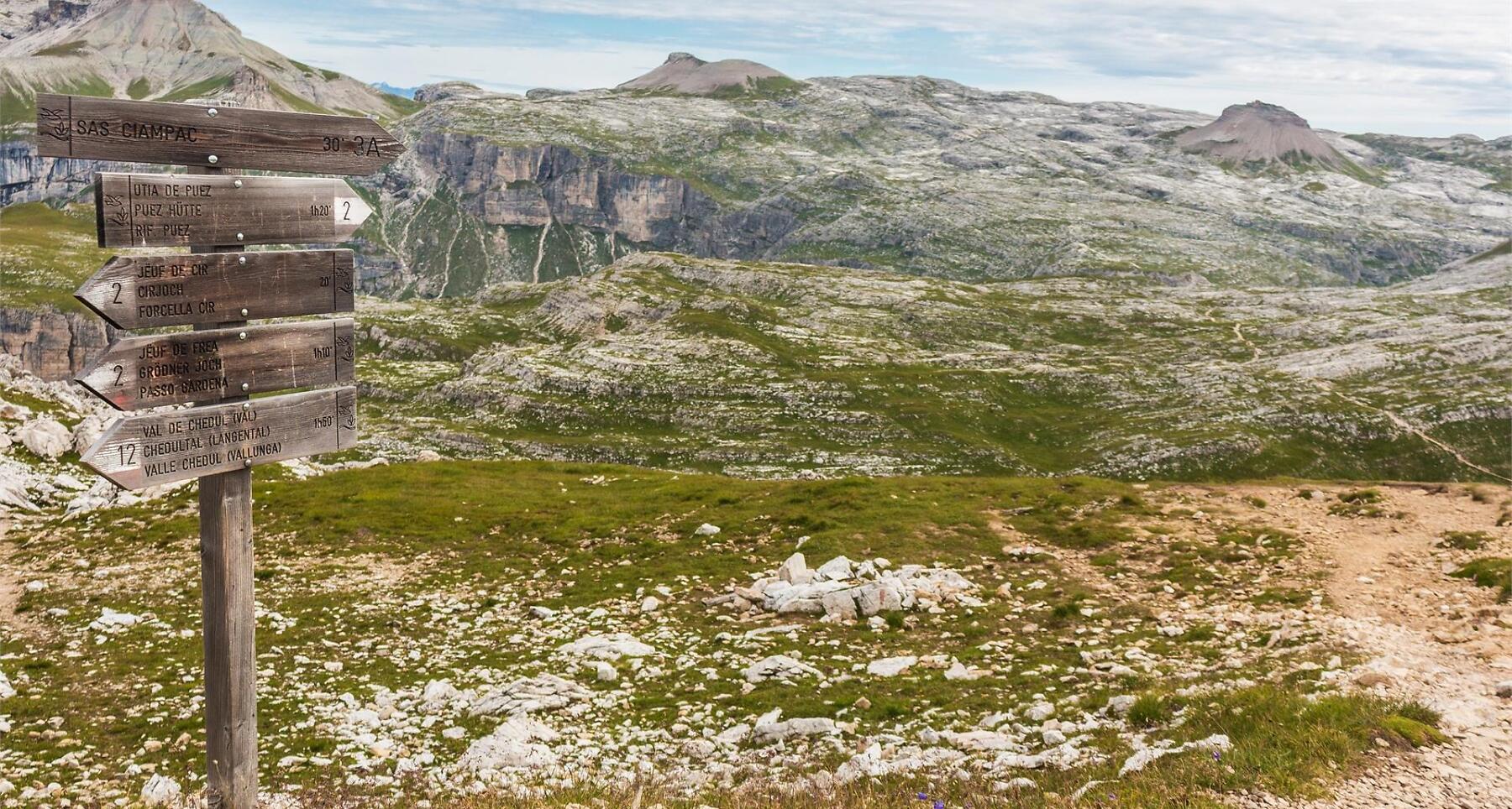
From the villages in Alta Badia you can reach the Gardena Pass (2,134 m) by service bus. Follow trail no. 2, which runs north-west through alpine pasture land, to the Jimmi hut. The hut can also be reached by the Plans-Frara gondola lift (from Colfosco). From the Jimmi hut continue on trail no. 2 up to the Cier passage (2,464 m) and the Crespëina ridge (2,531 m). Now the trail leads gently up and down to the Forcella Ciampëi passage (2,359 m) and on to the Puez hut (2,481 m).
You return on the same route as far as the Forcella Ciampëi passage (trail no. 2). Here trail no. 4 heads through the Stella Alpina valley back to Colfosco (1,624 m).
Public transport
Getting to the starting point of the tour or point of interest by public transport is easy and convenient.
How to get there
Follow the SS244 Val Badia road towards Corvara and continue on road SS243 to Colfosco.
Coordinates
- DD 46.549808, 11.806728
- DMS 46°32'59.3"N 11°48'24.2"E
- UTM 32T 715164 5158965
- w3w ///sulkily.meadow.snarl