


Fresh snow descent from the Valparola Pass to Armentarola


Ski mountaineering excursion on an easy route, particularly suitable for first off-piste experiences.
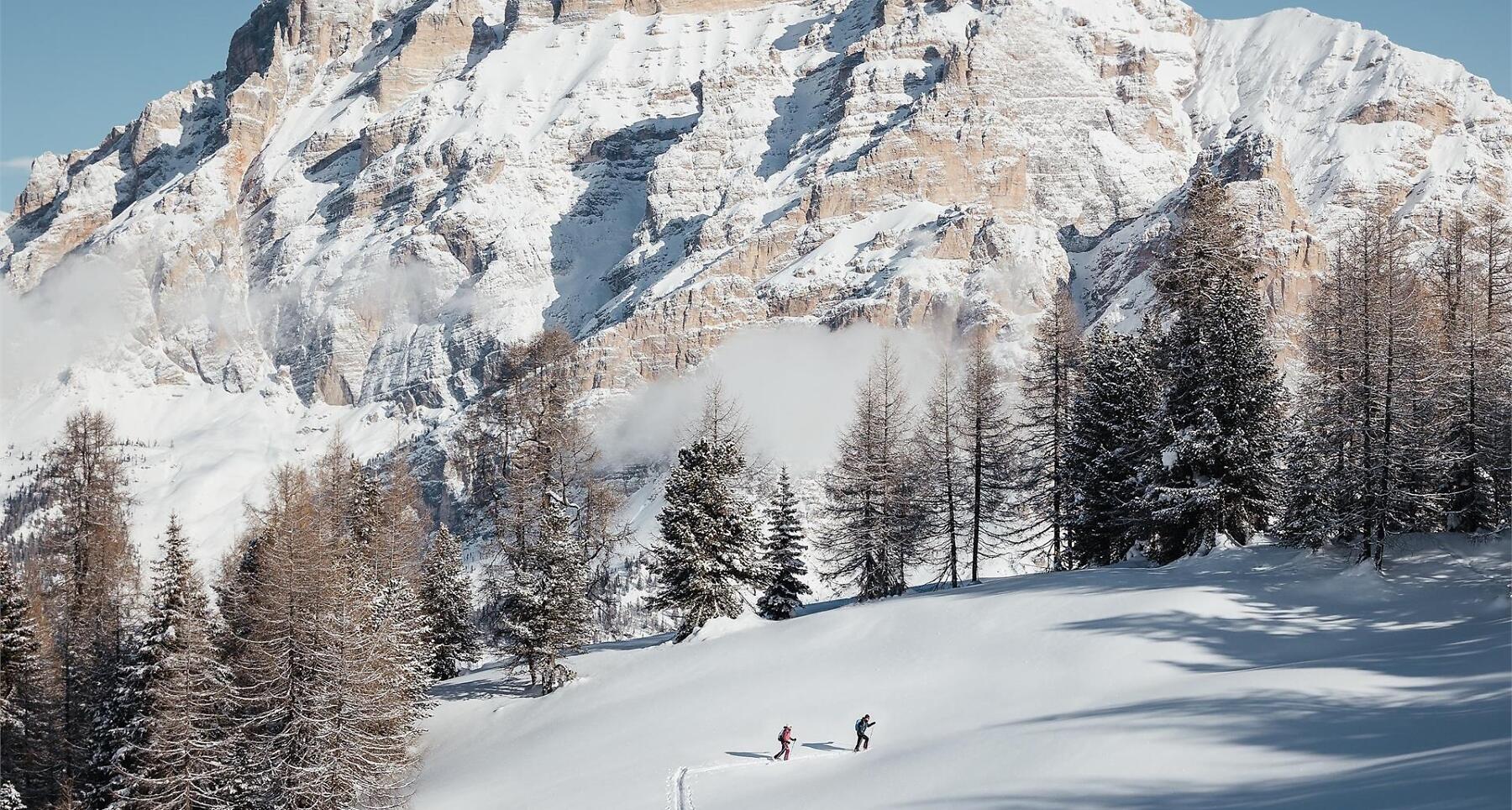
A ski mountaineering excursion on an easy and fascinating route, ideal for those approaching off-piste skiing for the first time. Passo Valparola, situated in a spectacular position with a splendid view of Lagazuoi, Sass de Stria, Setsas, Lavarela and Conturines, can be reached by car, bus or taxi (minibuses for 8-9 people) from Armentarola.
Roadbook
Starting behind the Valparola mountain hut, take the path towards the southern side of a small hill. From here follow the summer trail which first traverses a slight downhill slope and then levels out until it reaches an area of boulders where you climb diagonally across the slope at the base of the Piz Ciampëi up to the valley on the left. The descent towards Armentarola in an open valley is an easy, pleasant one. The first part, on an ideal terrain brings you down to a clearing. Here you continue skiing on the right hand side of the river and through the wood and get to the Malga Valparola hut, in a wide, sunny meadow. Take the path on your left which brings you down to Armentarola.
How to get there
Follow the SS244 Val Badia road towards La Villa and continue on road SS37 to San Cassiano.
Coordinates
- DD 46.531639, 11.988906
- DMS 46°31'53.9"N 11°59'20.1"E
- UTM 32T 729206 5157459
- w3w ///uncle.stinger.cheesecake