


Bike Beats - Fle Trail


Flowy trail across alpine meadows from Pralongiá to Corvara – 1120 m long, 134 m descent, easy to medium level.
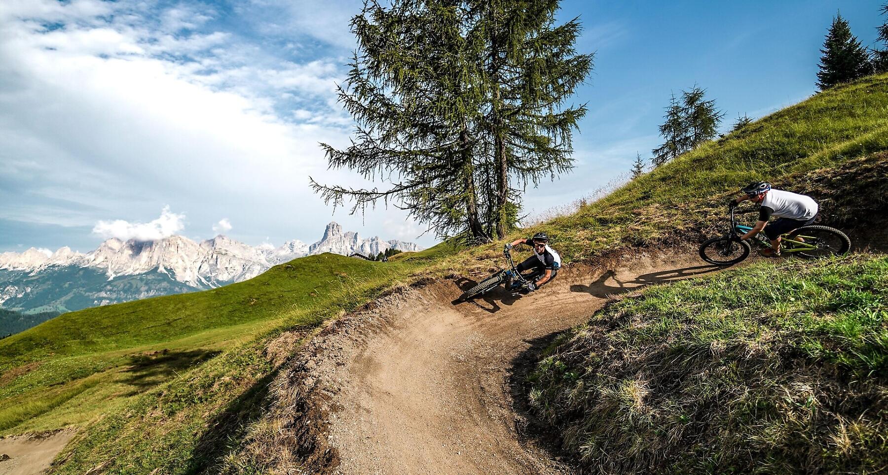
Bike Beats Pralongiá is a trail which goes through the meadows downhill from the Pralongiá. It is a medium-easy trail (blue) with a total length of 1120 metres and an altitude difference of 134 metres.
Roadbook
The trail starts from the forest road which descends from the Pralongiá or, when arriving from the other side, at the end of the mixed path (pedestrians-bikes) always going down the Pralongiá (alongside Biok). The Bike Beats Pralongiá trails start with a series of berms on the green hills of the meadows at the foot of the Pralongiá. It continues with some jumps (and alternative trails if you want to avoid them) and large berms. Without almost noticing it, you will also cross a swampy area going across a wavy north shore nicely blended into the scenery of the hills. Near the end, the bends start to become narrower, allowing more experienced bikers to pick up speed and make quicker turns. The trail then joins a dirt road which takes towards Planac.
Do not worry, the last section to reach the bottom of the valley is almost ready.
How to get there
Follow the SS244 Val Badia road towards Corvara.
Coordinates
- DD 46.531217, 11.899049
- DMS 46°31'52.4"N 11°53'56.6"E
- UTM 32T 722317 5157155
- w3w ///marginally.beads.moistens