


Dolomites World Heritage Geotrail II – Stage 6: from the Puez Hut to Armentarola

Pure alpine magic between Colfosco, Corvara and San Cassiano: from Puez’s rock sculptures to stunning views of the Marmolada and Sassongher.
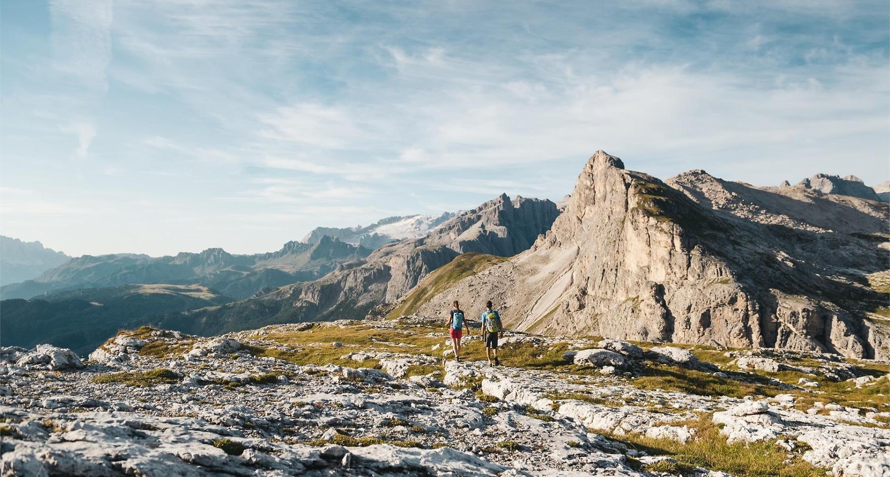
The impressively steep and rocky tooth of the Sassongher rises directly before us, while far to the south we see the imposing and majestic northwest wall of the Civetta. Merely crossing the plateau on which the Puez Hut is located represents a unique experience for mountaineers without vast geological knowledge, with bizarre rock formations that only a whim of nature could create. The Pralongiá plateau offers a breathtaking view of the largest glacier in the Dolomites, the north face of the Marmolada.
Discover more: https://www.dolomitiunesco.info/attivita/dolomites-world-heritage-geotrail/?lang=en
Roadbook
There are numerous paths signposted from the Puez Hut. We take Path no. 2, also marked as Dolomites Alta Via no. 2, and head for the Ciampei saddle. The path forks directly after the hut, where we keep left. Past another fork where we again keep right (GEOSTOP L) and follow Dolomites Alta Via no. 2 to the gap. From the saddle take Path no. 4 (signposted Colfosco/Kolfuschg) towards Col Pradat (cable car top station). We pass the small lake of Lech de Ciampai and reach the signposted turnoff to Sassongher, which we ignore. At the next fork (path down to Colfosco) go straight on (Path no. 4A) towards the top station of the cable car. Before the trail joins the access road to the chairlift, turn left onto the signposted descent to Corvara. Path no. 4A leads down to the hamlet of Pescosta above Corvara and then on to the main road. We cross this then turn left. The Col Alt Hotel is located just off the main road. The marked path (Path no. 2B) up to the Col Alt begins from the car park directly behind the hotel. Go past the top station of the lift to reach the first bend in the dirt road, which we follow until the fourth bend where several paths lead off. Go straight ahead on Path no. 23 through meadows and up through the forest until the path joins the dirt road up to the Piz Arlara (top station of lift), which we follow past the buildings and along the road until a narrow gravel road turns off to the right. Take this to the junction with the Tru Panoramich (Path no. 23), which in turn leads via the plateau towards the Pralongiá Hut. Shortly before Pralongiá, leave the road (signposted) and take the path (still the Tru Panoramich) for the Pralongiá Hut. We pass the hut and continue to the next marked turn (Path no. 24) to Armentarola and GEOSTOP M.
Public transport
Getting to the starting point of the tour or point of interest by public transport is easy and convenient.
How to get there
Follow the SS244 Val Badia road towards Badia.
Coordinates
- DD 46.590055, 11.829249
- DMS 46°35'24.2"N 11°49'45.3"E
- UTM 32T 716730 5163498
- w3w ///deluges.lovable.segment