


4 Peaks Alta Badia


Between Badia and San Cassiano four peaks, one goal: The “4 Peaks Alta Badia” challenge for true mountain professionals – adrenaline, adventure, and a reward with an honorary place!
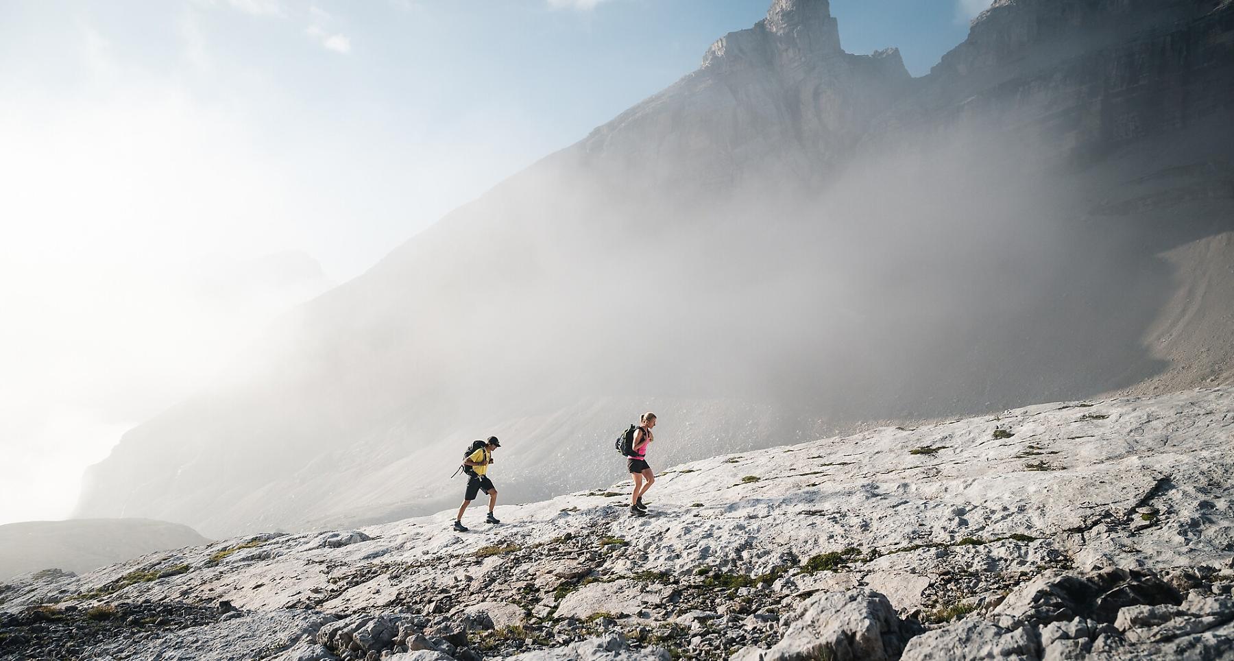
Adventure, adrenaline, and breathtaking views: that is what awaits you in the exciting challenge “4 Peaks Alta Badia”. The goal of the challenge is to conquer the four peaks Sas dla Crusc - Heiligkreuzkofel 2,907m, Piza dales Diesc - Zehnerspitze 3,026m, Lavarela 3,055m and Conturines 3,064m, on the edge of the Fanes-Sennes-Prags Nature Park in the UNESCO Dolomites World Heritage site.
Climbing the four mountains is primarily for experienced climbers. The peaks are not reached on easy, well-marked hiking trails, but on paths with sometimes very exposed sections.
To participate in the “4 Peaks Alta Badia” challenge, you must register online at www.4peaks.it.
Proof of your achievement will be a pass that must be stamped each time you reach one of the four peaks. Those who complete the route in two or more days will be allowed to carry the title “Alta Badia Finisher”.
Those who can climb all four peaks in a single day will win the coveted and well-deserved title “Alta Badia Mountaineer”. Both as a finisher and as a mountaineer, you will then take an honorary place in the "Wall of Fame", which can be viewed online.
Roadbook
From the village of Badia (1,324 m), take the La Crusc 1 chairlift and the La Crusc 2 gondola up to La Crusc/Heilig Kreuz at the foot of the imposing Sas dla Crusc/Heilig Kreuz massif.
From the pilgrimage site La Crusc/Heilig Kreuz (2,045 m), take path no. 7 towards Ju dla Crusc Pass (2,612 m) where path no. 7B leads to the summit of Sas dla Crusc/Heilig Kreuz (2,907 m). Over a short via ferrata you then reach the Piza dales Diesc/Zehnerspitze (3,026 m). The descent back to the Ju dla Crusc junction is via path no. 7B.
At the Ju dla Crusc junction there are two routes to reach the Lavarela and Conturines peaks: a shorter but more demanding and exposed route and a longer but easier and less exposed one.
Shorter, more exposed route
From the Ju dla Crusc junction take path no. 7 and then path no. 12 to the Medesc notch (2,533 m). Past the Medesc junction, you reach the Lavarela (3,055 m) summit. The path between the Medesc notch and the Lavarela summit is very exposed and recommended only for experienced climbers. The Conturines summit, the last peak of the route and the highest of the four at 3,064 m, is reached via path no. 12B and a via ferrata. The return to the valley is relatively easy. Take path no. 12B, hike over the Fanes meadows and continue on path no. 11 to Col de Locia and Capanna Alpina (1,720 m). In the village of Capanna Alpina you have the option to park your car or take a taxi. A little further ahead, in Sciaré, there is a bus stop. Buses run several times a day.
Less exposed but longer route
From the Ju dla Crusc junction, continue hiking on paths no. 7 and no. 12 towards Fanes and past the mountain huts Lavarella and Fanes (2,050 m). On path no. 11 continue past Lake Lech de Limo and the Fanes alp to reach the small junction Ju dal’Ega (2,157 m). From here continue on path no. 12B up to the two peaks Lavarela (3,034 m) and Conturines (3,064 m). Attention: the last section to the Conturines peak is a via ferrata.
The return route is the same way back to the Fanes alp where path no. 11 leads to Col de Locia (2,069 m) and finally to the village of Capanna Alpina (1,720 m). There are sufficient parking spaces in Capanna Alpina and you will also find a taxi service here.
Public transport
The starting point of the route or the attraction is easily and conveniently accessible by public transport.
How to get there
Follow the SS244 Gadertal Road towards Badia.
Coordinates
- DD 46.614436, 11.938619
- DMS 46°36'52.0"N 11°56'19.0"E
- UTM 32T 725007 5166514
- w3w ///layover.falafel.tangible