


Via ferrata Piz da Lech


The Piz da Lech via ferrata in Corvara is a short but intense route of medium difficulty with some challenging sections. Good preparation and experience are therefore necessary.
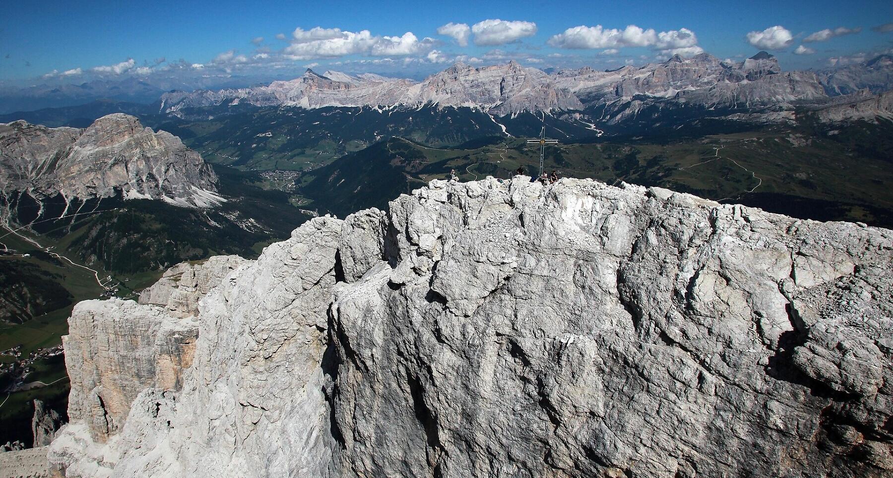
This impressive via ferrata (equipped trail) winds through chimneys and crevices, steep passages and two vertical ladder ascents up to a breathtaking summit in the Sella group. The access to the via ferrata is located near the Kostner mountain hut, at the top station of the Vallon lift. The hut can be reached from Corvara with the Boé gondola or on foot with an ascent from the Campolongo pass.
Roadbook
Starting at the top station of the Vallon chairlift, follow the signs in a northerly direction to a scree valley, where you will turn right uphill until you reach the start of the via ferrata in approx. 15 minutes. The route starts with a medium-difficulty rocky leap and proceeds with an easy ledge on the left and some rocks steps. After a few more rocky leaps, you will climb vertically for a few meters and then find yourself inside a long gully where you will have to stay on the right-hand side.
After a few meters, the gully narrows and you will have to climb about fifteen meters vertically, and then face a short but exposed section to the right, before reaching a ledge. You will now climb towards a rather demanding passage, after which you will reach a particularly spectacular spot: under the rock face two ladders rise up, interspersed with a passage on rock. At the end of the second staircase, you will be presented with a further passage that can be climbed with the help of some brackets. The final section of the ferrata now involves overcoming a few small rocks and then a ramp that will take you to a summit ridge. After a few meters with the equipment on the right, you will find yourself on a path and shortly afterwards encounter a short suspension bridge consisting of a horizontal ladder over a narrow crevasse. You will now ascend a short wall and some small rocks, and then find yourself on the high-altitude path leading to the summit cross (2,916 m), a section that is not excessively exposed but not equipped.
The return is southwards along the normal route (no. 646) along scree. You will have to descend through a couple of equipped passages, namely a vertical wall of about 6 to 8 meters and a short series of small rocks. You will then reach a crossroads: going to the right, you will walk along a landslide gully which will take you to the access path to the ferrata, from where you can reach the mountain station of the chair lift, while continuing on path no. 646 you will arrive along a ridge above Lake Boé and then at the station of the Boé cable car.
Public transport
Getting to the starting point of the tour or point of interest by public transport is easy and convenient.
How to get there
Follow the SS244 Val Badia road towards Corvara.
Coordinates
- DD 46.524148, 11.845909
- DMS 46°31'26.9"N 11°50'45.3"E
- UTM 32T 718270 5156221
- w3w ///seducing.winkle.squashes