


Cross-country skiing in quiet wonder
First, the hush of snow-draped forests, then the soft whisper of skis on untouched trails. Some wander slowly, letting the landscape unfold, others move with the pulse of exhilaration. In Alta Badia, every skier discovers their own rhythm, and moments of quiet magic that linger long after the snow has melted.
Cross-country trail San Cassiano - Sprint
Cross-country skiing
- Alta Badia
closed
Alta Badia Tourism Cooperative
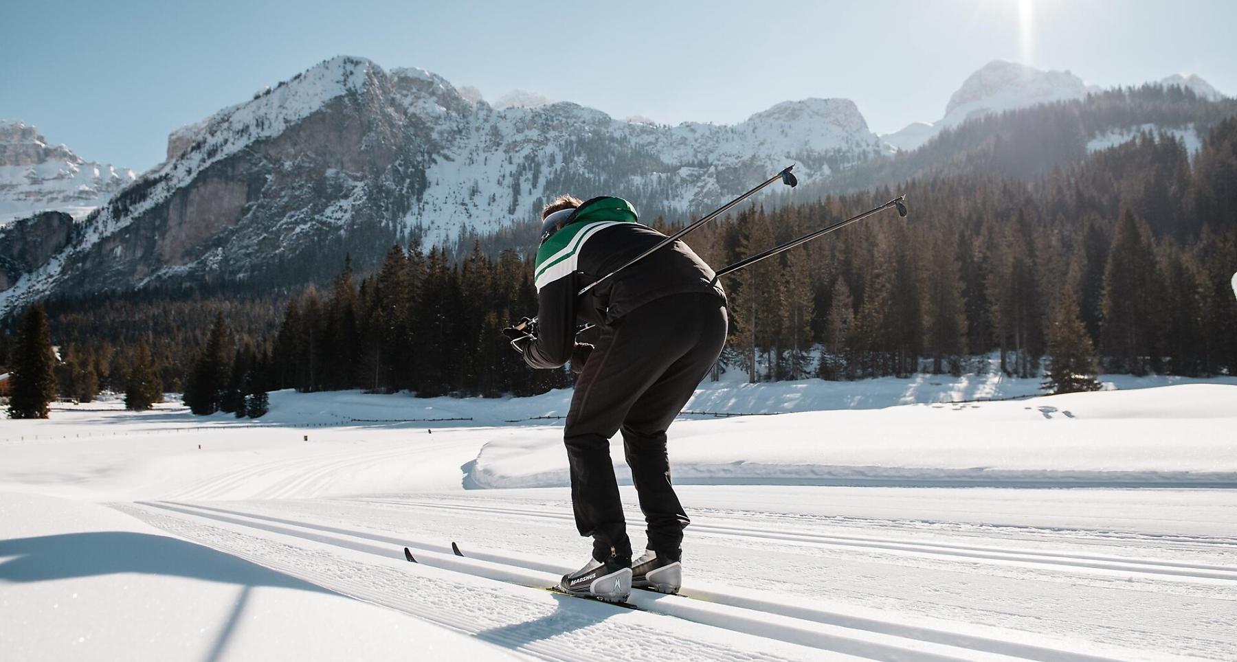
Sprint cross-country skiing slope
Pictures:
Alta Badia/Alex Moling, Alta Badia Tourism Cooperative

Sprint cross-country skiing slope
Pictures:
Alta Badia/Alex Moling, Alta Badia Tourism Cooperative
The route
The route
Details
Roadbook
How to get there
The slope is prearranged as agonistic and training area through the beautiful woods of San Cassiano.
Difficulty
Difficult
Experience
Landscape
Best time of year
Jan
Feb
Mar
Apr
May
Jun
Jul
Aug
Sep
Oct
Nov
Dec
Track types
Roadbook
The cross country area Alta Badia - Enervit in Saré/Armentarola, at 3 km distance from San Cassiano town centre, counts approximately 25 km of tracks.
How to get there
Follow the SS244 Val Badia road towards La Villa and continue on road SS37 to San Cassiano.
Coordinates
- DD 46.553796, 11.966532
- DMS 46°33'13.7"N 11°57'59.5"E
- UTM 32T 727397 5159856
- w3w ///parks.chromosome.sturdily
Status
closed
Distance
1,2
km
Duration
0:20
h
Ascent
20
m
Descent
20
m
Highest point
1.668
m
Lowest point
1.649
m